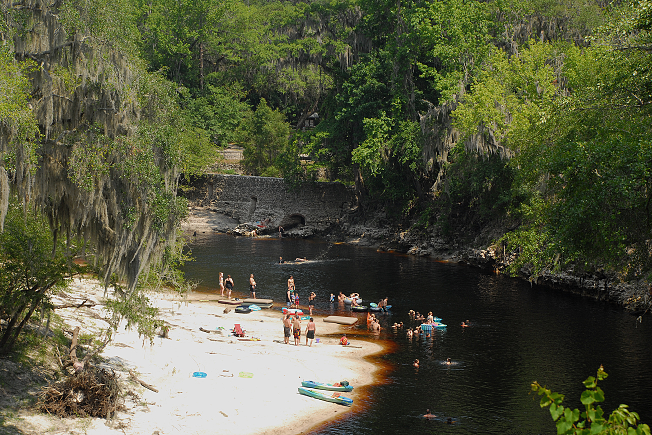
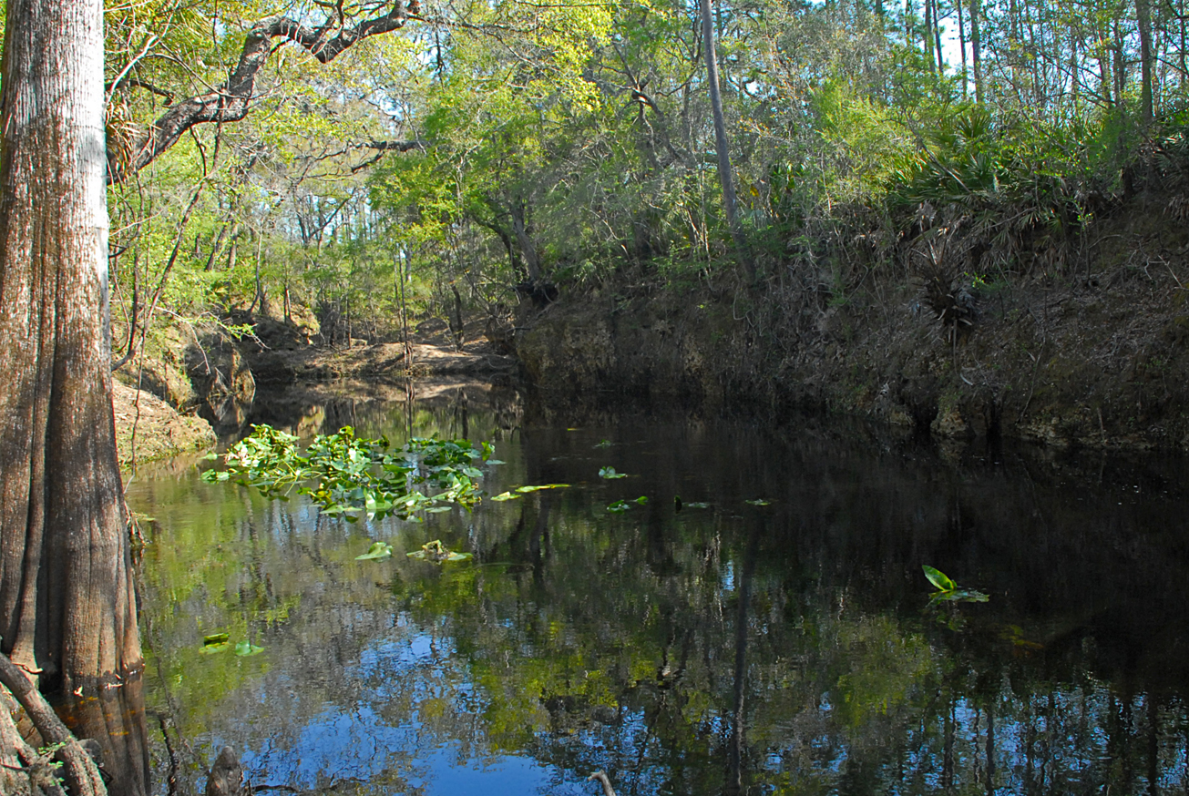
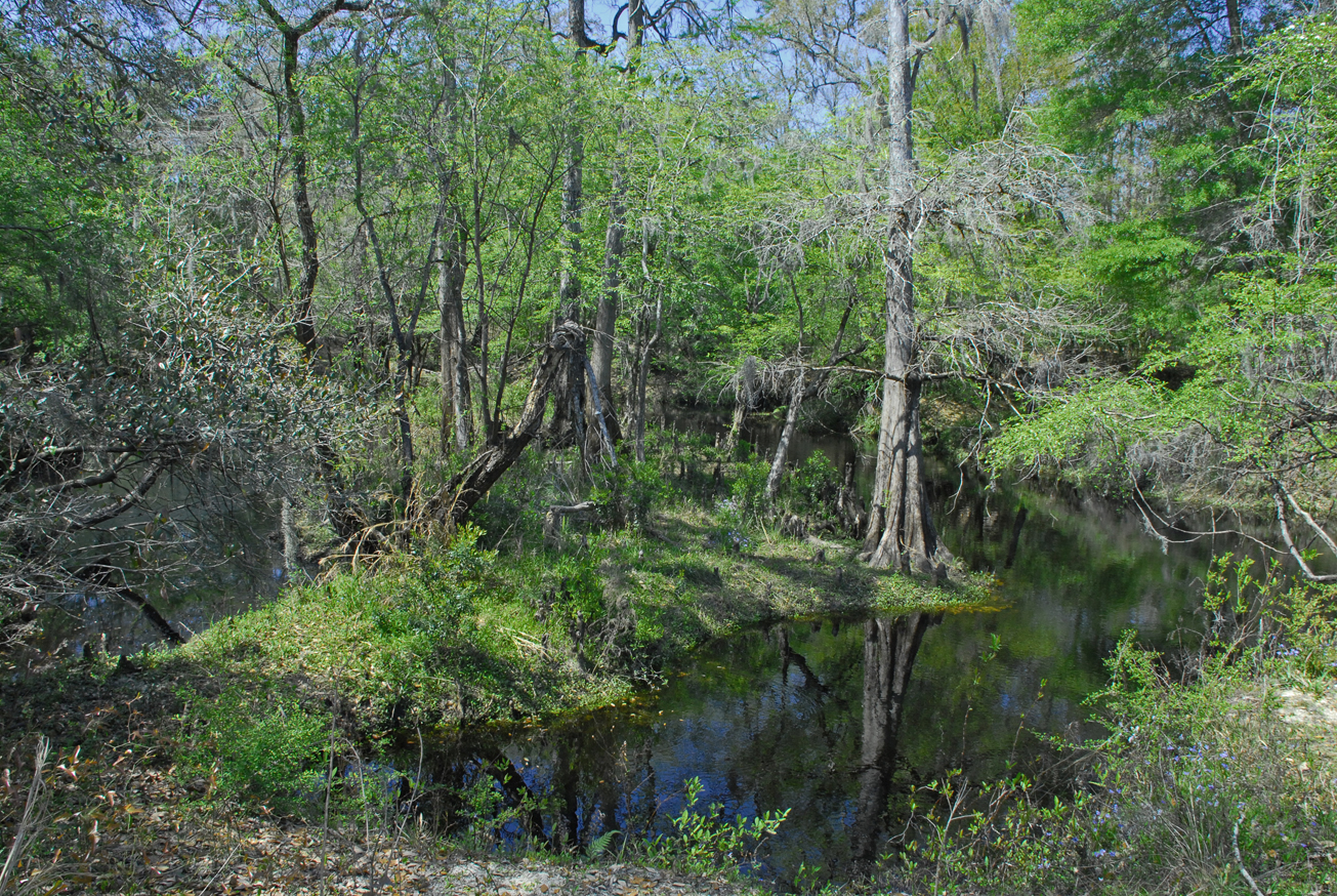
View Tract Details

WOODS FERRY

Recreation
The Woods Ferry tract features a canoe launch. Visitors may enjoy biking, fishing, hiking, horseback riding, and wildlife viewing on administrative roads.

Access
Woods Ferry Tract from Live Oak:
Travel north on US 129, turn right on CR 136A, travel 4 miles east on CR 136A, turn left on 57th Drive; travel 1 mile north on 57th Drive. The entrance is straight ahead at the 90° right turn – enter the property on Woods Ferry Path.

Woods Ferry Tract from White Springs:
Travel southwest on CR 136, turn right on CR 136A; travel 3 miles to 57th Drive and turn right. Access to the Jerry Branch tract from White Springs: Travel west on CR 25A, cross I-75, immediately turn left on SE 134th Avenue; travel .25 miles south and the first entrance is on the right; continue south and there are two entrances on the right.
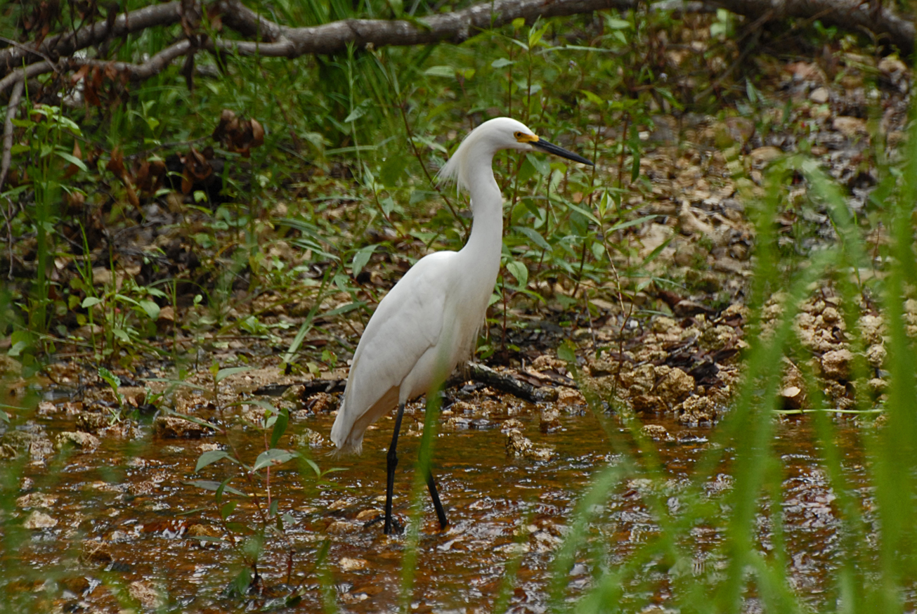
View Tract Details

WALKER

Recreation
The Walker Tract visitors may enjoy fishing, as well as biking, hiking, horseback riding, and wildlife viewing. Canoes, kayaks or small boats may be hand launched at the canoe launch. The Walker Tract is part of the Troy Springs Wildlife Management Area and offers small game and turkey hunting.

Hunting is allowed in permitted areas only. For more information on hunting, contact the Florida Fish and Wildlife Conservation Commission at:

386-758-0525
Florida Fish and Wildlife Conservation Commission

Access
Walker Tract from Mayo:
Travel south on US 27 4 miles to NE CR 421, turn left; travel north 1.25 miles past Troy Springs State Park and the tract entrance is on the right. Once past Troy Springs State Park the pavement ends and the road becomes NE Jeff Walker Road.

View Tract Details

SULLIVAN TRSF

Recreation
On this primitive site, visitors may enjoy fishing, canoe launch, as well as biking, hiking, horseback riding, and wildlife viewing on administrative roads.

The Sullivan tract is part of Twin Rivers State Forest. For more information, call or visit:

386-208-1460
Florida Department of Agriculture and Consumer Services Website

Access
Sullivan tract from Madison:
Travel north on CR 149 to CR 150, turn right; the tract is on the Withlacoochee River.

Size
Sullivan – 376 acres

View Tract Details

SUWANNEE SPRINGS

Recreation
The Suwannee Springs Tract is home to Suwannee Springs Park. The historic park features the old spring house that was built in the 1800s around the sulfur springs. Visitors can swim in the springs, picnic, and enjoy the snow white river sand bars.

Visitors may also enjoy fishing, as well as biking, hiking, and wildlife viewing.

Access
Suwannee Springs Tract:
Travel north on US 129, turn right on 93rd Drive (Old US 129), travel north to 32nd Street, turn right, and follow the street to the parking lot.

View Tract Details

SUWANNEE SPRINGS PARK

Recreation
The Suwannee Springs Park is a historic park featuring the old spring house that was built in the 1800s around the sulfur springs. Visitors can swim in the springs, picnic, and enjoy the snow white river sand bars.

Visitors may also enjoy fishing, as well as biking, hiking, and wildlife viewing on the Suwannee Springs Tract’s administrative roads. Canoes and kayaks may be launched from the Suwannee Springs Launch.

Access
Suwannee Springs Park:
Travel north on US 129, turn right on 93rd Drive (Old US 129), travel north to 32nd Street, turn right, and follow the street to the parking lot.

View Tract Details

SCANLON

.

Recreation
Visitors may enjoy biking, hiking, horseback riding, and wildlife viewing. roads, in addition to fishing and hunting. Many of the river access points provide launches for canoes or small boats.

The Econfina River traverses the tract from the north boundary to the southern boundary.  The river’s 239-square mile basin drains part of the Big Bend Region.  Its headwaters in San Pedro Bay, the Econfina River’s character changes dramatically as it winds 44-miles through upland forests and meanders downstream to the palm-fringed salt marshes of the Gulf of Mexico.

The name “Econfina” derives from the Creek ekana, which means “earthy”, and feno, which means “bridge” or “foot log”. This name may refer to a natural bridge over the river in the Natural Well Branch Tract.

This tract is part of the Lower Econfina River Wildlife Management Area.

Hunting is allowed in permitted areas only. For more information on hunting, contact the Florida Fish and Wildlife Conservation Commission at:

386-758-0525
Florida Fish and Wildlife Conservation Commission Website

Access
Scanlon Tract from Perry:
Travel west approximately 16 miles on US 98 and the entrance is on the left before crossing the Econfina River.

View Tract Details

SCANLON

Recreation
Visitors may enjoy biking, hiking, horseback riding, and wildlife viewing, in addition to fishing and hunting. Many of the river access points provide launches for canoes or small boats.

The Econfina River traverses the tract from the north boundary to the southern boundary.  The river’s 239-square mile basin drains part of the Big Bend Region.  Its headwaters in San Pedro Bay the Econfina River’s character changes dramatically as it winds 44-miles through upland forests and meanders downstream to the palm-fringed salt marshes of the Gulf of Mexico.

The name “Econfina” derives from the Creek ekana, which means “earthy”, and feno, which means “bridge” or “foot log”. This name may refer to a natural bridge over the river in the Natural Well Branch Tract.

This tract is part of the Lower Econfina River Wildlife Management Area.

Hunting is allowed in permitted areas only. For more information on hunting, contact the Florida Fish and Wildlife Conservation Commission at:

386-758-0525
Florida Fish and Wildlife Conservation Commission Web

Access
Scanlon tract from Perry:
Travel west approximately 16 miles on US 98 and the entrance is on the left before crossing the Econfina River.

View Tract Details

STEINHATCHEE FALLS

Recreation
On the Steinhatchee Falls Tract visitors may enjoy fishing, biking, hiking, horseback riding, and wildlife viewing on administrative roads. Canoes , kayaks and small boats may be launch at Stephens Landing (River Access 10.8) or Steinhatchee Falls Park (River Access 9.7).

The Steinhatchee Falls Park features a small scenic waterfall. The Steinhatchee Trail is a 3-mile, multi-use trail that begins at the trail head on SR 51 and ends at the park.

Access
Steinhatchee Falls tract from Perry:
Travel south on US 19 to SR 51, turn right and the tract is on the left past the convenience store.

Steinhatchee Falls tract from Cross City:
Travel north on US 19, turn left on SR 51 and the tract begins on the left past the convenience store.

Entrance to Steinhatchee Falls Park from US 19 and SR 51:
Travel 1.75 miles south on SR 51 to Steinhatchee Falls Road, turn left and follow the road to the dead end, turn right and the road ends at the park.

View Tract Details

STEINHATCHEE FALLS PARK

Recreation
At Steinhatchee Falls Park is a part of the much larger Steinhatchee Falls Tract. Visitors may enjoy fishing, hiking picnicking, and wildlife viewing. The Park features a small scenic waterfall. The Steinhatchee Trail is a 3-mile, multi-use trail that begins at the trail head on SR 51 and ends at the park. Canoes, kayaks and small boats can be launched at the boat ramp in the park.

Access
Steinhatchee Falls Park from Perry:
Travel south on US 19 to SR 51, turn right, travel 1.75 miles south on SR 51 to Steinhatchee Falls Road, turn left and follow the road to the dead end, turn right and the road ends at the park.

Steinhatchee Falls Park from Cross City:
Travel north on US 19, turn left on SR 51, travel 1.75 miles south on SR 51 to Steinhatchee Falls Road, turn left and follow the road to the dead end, turn right and the road ends at the park.

View Tract Details

STEINHATCHEE RISE

Recreation

The Steinhatchee Rise Tract is part of the Steinhatchee Springs WMA. Visitors may enjoy biking, hiking, horseback riding, and wildlife viewing, in addition to fishing and hunting. Canoes, kayaks, and small boats may launch at some of the river access points.

For more information on hunting, contact the Florida Fish and Wildlife Conservation Commission at:

386-758-0525
Florida Fish and Wildlife Conservation Commission Website

Access
Steinhatchee Rise Tract from Perry:
Travel south on US 19, cross the Steinhatchee River Bridge; travel 1.75 miles to SW 700th Street, turn right and the tract is on the right.

Steinhatchee Rise Tract from Cross City:
Travel north on US 19, turn left on SW 700th Street and the tract is on the right.