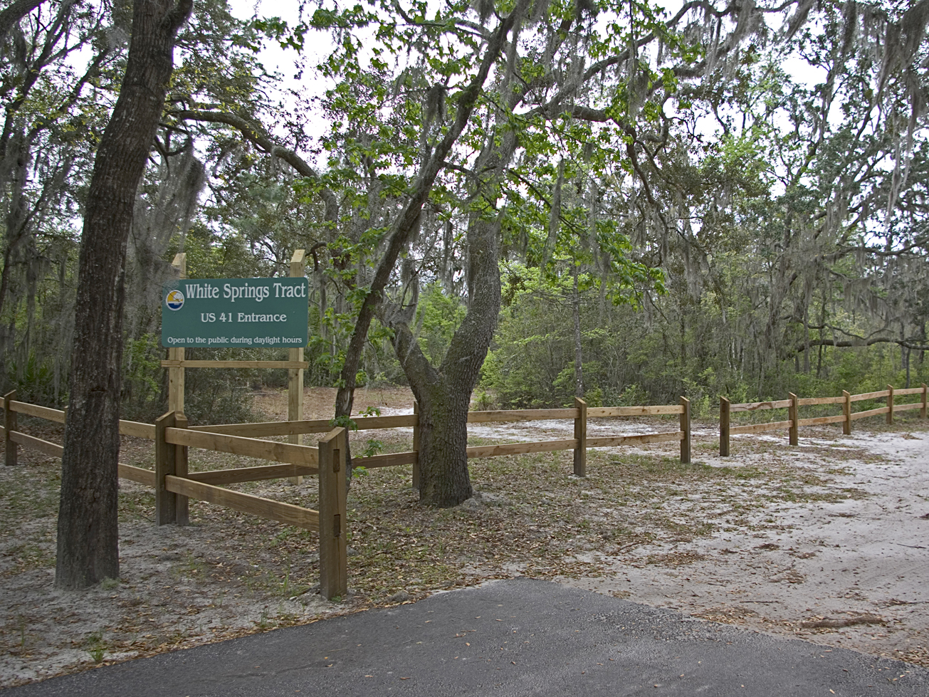
View Tract Details

WHITE SPRINGS

Recreation

White Springs Tract

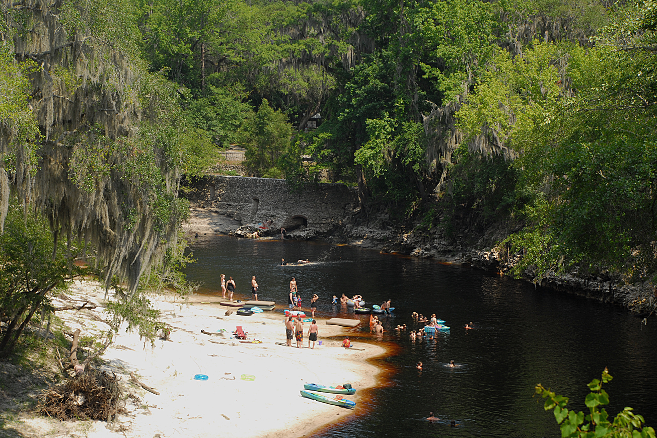
White Springs includes approximately 1 ½ miles of river frontage along the Suwannee River. White Springs is well known for wild azaleas blooming along the river bank in the spring and its bicycle trail.

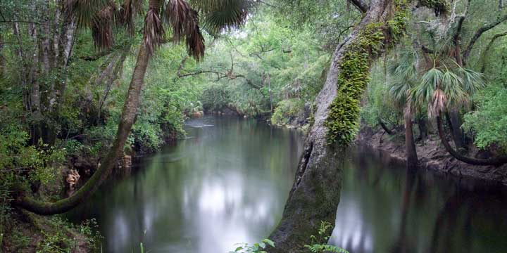
The Florida National Scenic Trail (FNST) rambles through the White Springs tract along the river bank on its journey across Florida. The FNST begins at Big Cypress in the Everglades and extends to Gulf Islands National Seashore in the western panhandle.  It shares a treadway with the bicycle trail built and maintained by Suwannee Bicycle Association

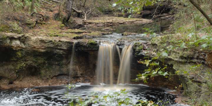
White Springs tract contains a range of biodiversity including mesic flatwoods, scrubby flatwoods, wet flatwoods, bottomland forest, dome swamp and basin swamp natural communities at the base of the Cody Enscarpment.  The Cody Scarp is a geomorphologic formation that runs across north and central Florida. It approximates an ancient shoreline of Florida from a time when sea levels were much higher. The Cody Scarp represents the largest continuous topographic break in Florida. For more information about the Cody Scarp, visit mysuwanneeriver.com.

Visitors may enjoy wildlife viewing, fishing, hiking, and biking on administrative roads and designated trails.

Bicycling and Hiking at the White Springs tract

Bridge to Bridge Trail – The 4.5-mile single-track intermediate to challenging trail has plenty of sharp turns, climbs and descents.  It follows the river for more than a mile with many scenic overlooks.  Experienced off-road riders with good technical riding skills will enjoy this trail.  It easily connects to the Gar Pond Trail on the Gar Pond tract and the Beast of Burden Trail on the Little Shoals tract for longer rides.

Florida National Scenic Trail -From Suwannee River Wayside Park Trailhead hikers will enter the District owned White Springs tract. The 3.5-mile trail passed through scrubby oaks, saw palmetto and pines along the Suwannee River.  It exits the tract at the Adams Memorial Circle Trailhead. From there hikers will have opportunity to road walk through Historic Downtown White Springs to Stephen Foster Culture Center State Park.  On the White Springs tract hikers, will share portions of the trail with bicycles.  For a loop trail the hiker can follow the administrative road (5 miles total) back through the tract or follow the sidewalk (4.5 miles total) along US 41 back to the Suwannee River Wayside Park Trailhead

Access
White Springs tract from White Springs:
Travel south on US 41, turn right on Adams Memorial Circle, go past Riverside Cemetery. The pavement ends and the street becomes dirt; the tract entrance is on the right. The second entrance is at the US 41 boat ramp.

View Tract Details

SUWANNEE SPRINGS PARK

Recreation
The Suwannee Springs Park is a historic park featuring the old spring house that was built in the 1800s around the sulfur springs. Visitors can swim in the springs, picnic, and enjoy the snow white river sand bars.

Visitors may also enjoy fishing, as well as biking, hiking, and wildlife viewing on the Suwannee Springs Tract’s administrative roads. Canoes and kayaks may be launched from the Suwannee Springs Launch.

Access
Suwannee Springs Park:
Travel north on US 129, turn right on 93rd Drive (Old US 129), travel north to 32nd Street, turn right, and follow the street to the parking lot.

View Tract Details

STEINHATCHEE FALLS

Recreation
On the Steinhatchee Falls Tract visitors may enjoy fishing, biking, hiking, horseback riding, and wildlife viewing on administrative roads. Canoes , kayaks and small boats may be launch at Stephens Landing (River Access 10.8) or Steinhatchee Falls Park (River Access 9.7).

The Steinhatchee Falls Park features a small scenic waterfall. The Steinhatchee Trail is a 3-mile, multi-use trail that begins at the trail head on SR 51 and ends at the park.

Access
Steinhatchee Falls tract from Perry:
Travel south on US 19 to SR 51, turn right and the tract is on the left past the convenience store.

Steinhatchee Falls tract from Cross City:
Travel north on US 19, turn left on SR 51 and the tract begins on the left past the convenience store.

Entrance to Steinhatchee Falls Park from US 19 and SR 51:
Travel 1.75 miles south on SR 51 to Steinhatchee Falls Road, turn left and follow the road to the dead end, turn right and the road ends at the park.

View Tract Details

LUKENS

Recreation
This tract is managed by the U.S. Fish and Wildlife Service as part of the Cedar Keys National Wildlife Refuge. Visitors may enjoy fishing, hiking and wildlife viewing, as well as paddling. There is a kayak launch on the tract on the east side of SR 26. For more information, contact the Cedar Keys National Wildlife Refuge at:

352-493-0238
U.S. Fish and Wildlife Service – Cedar Keys Page

Access
Lukens tract from Cedar Key:
Travel north 3.5 miles from Cedar Key on SR 26, turn right on SW 153rd Court, travel north .25 mile and entrance gate to the east side is on the right. Public access to the Lukens tract east side is by special use authorization (SUA). An SUA is free and available by calling (386-362-1001) or emailing the District. Obtaining an SUA may take 3-5 business days.

Lukens access on the west side of SR 26.


View Tract Details

JENNINGS BLUFF

Recreation
On this tract, visitors may enjoy fishing, as well as biking, hiking, horseback riding, and wildlife viewing on administrative roads.

The Jennings Bluff tract has a canoe launch and part of The Great Florida Birding Trail.

Alapaha River

The 202-mile-long Alapaha River is a tributary of the Suwannee River flowing through South Georgia and North Florida with three tributaries the Willacoochee, Alapahoochee and Little Alapaha Rivers. The final twenty-five miles in North Florida is an intermittent river during periods of low volume. Most of the water disappears underground into swallets in the river bed and a “blind valley” and becomes a subterranean river approximately 2.3 miles below Jennings, FL.

Dead River

A major swallet is at the terminus of the blind valley known as the Dead River and Dead River Sink.  Blind valleys are karst features where surface water is diverted from a river and flows into a channel to a swallet or sinkhole recharging the aquifer.  The Dead River is a distributary of the Alapaha where the water flows upstream to the Dead River Sink and disappears into an opening in the rock wall.  During extreme low water conditions, the Dead River may be dry.

A dye trace study conducted in 2016 by the District and Florida Geological Survey introduced dye into the Dead River Sink, six days later it appeared in Holton Creek Rise and Alapaha Rise ten miles to the south.  Both flow into the Suwannee River.

Cody Escarpment (Cody Scarp) traverses the southwest corner of the tract. The Cody Scarp is a geomorphologic formation that runs across north and central Florida. It approximates an ancient shoreline of Florida from a time when sea levels were much higher. The Cody Scarp represents the largest continuous topographic break in Florida. For more information about the Cody Scarp, visit mysuwanneeriver.com.

Access
Jennings Bluff tract from Jasper:
Travel north on US 41, turn right on NW 25th Lane; travel approximately 2 miles east and the entrance is on the left.

View Tract Details

FALLING CREEK FALLS

Recreation
Falling Creek Falls is one of the District’s gems. During normal water levels the creek roars over a 10-foot waterfall and flows under Falling Creek Road through a deep ravine before going underground.

The park area is managed through a partnership with Columbia County. For park information, contact Columbia County. The District portion of the tract can be access through the county park.

386-758-2123
Columbia County Florida Website

Access
Falling Creek Falls Tract from Lake City:
Travel north on US 41, pass under I-10, turn right on NW Falling Creek Road; travel 1 mile. The park is on the right before crossing the creek.

View Tract Details

CABBAGE GROVE

Recreation
On the Cabbage Grove visitors may enjoy biking, hiking, horseback riding, and wildlife viewing, in addition to fishing and hunting. Many of the river access points provide launches for canoe or small boats.

Cabbage Grove is part of the Aucilla Wildlife Management Area. Hunting is allowed in permitted areas only. For more information contact the Florida Fish and Wildlife Conservation Commission at:

850-265-3676
Florida Fish and Wildlife Conservation Commission Website
Aucilla Bird List


Access
Cabbage Grove Tract from Perry:
Travel 22 miles west on US 98 to Powell Hammock Road, turn right; travel north 4 miles, turn left on Goose Pasture Road; travel west .25 miles and the tract is on the right.


View Tract Details

DEVIL’S HAMMOCK

Recreation
Public use is managed by the Levy County. Visitors may enjoy biking, hiking, horseback riding, and wildlife viewing on administrative roads, in addition fishing and hunting. A picnic pavilion is available at the river camp.

352-486-5127

Levy County

Hunting is allowed in permitted areas only. For more information on hunting, contact the Florida Fish and Wildlife Conservation Commission at:

386-758-0525
Florida Fish and Wildlife Conservation Commission Website

Access
Devil’s Hammock Tract from Bronson:
Travel west on SR 24 and the tract is on the right. There are four entrances into the property: the Southwest Trailhead, Parker Field, River Camp, and the Hunter Check Station.

View Tract Details

BIG SHOALS PUBLIC LANDS

Big Shoals Public Land is owned by three agencies Florida Department of Environmental Protection (Big Shoals State Park), Florida Forest Service (Big Shoals State Forest), Suwannee River Water Management District and managed as Big Shoals Public Lands. For information on Big Shoals State Park and Big Shoals State Forest contact:

386-397-4331

Big Shoals State Park Website

386-208-1460

Big Shoals State Forest Website

Recreation
Big Shoals offers 28 miles of trails, including the paved multi-purpose Woodpecker Trail, and a canoe launch for the outdoor enthusiast. Here you can view the only stretch of major whitewater rapids in Florida.

Visitors may enjoy biking, hiking, horseback riding, and wildlife viewing on administrative roads. Hunting is allowed on the Big Shoals tract, which is part of the Big Shoals Wildlife Management Area.

For more information on hunting, contact the Florida Fish and Wildlife Conservation Commission at:

386-758-0525
Florida Fish and Wildlife Conservation Commission Website

Note: Hunting is allowed in permitted areas only.


Access
Big Shoals Public Lands from White Springs:
Travel north from White Springs on CR 135 and turn right into the Little Shoals entrance or continue 2 miles north on CR 135 and turn right on SE 94th Street (Old Goodwin Bridge Road), which ends at the second entrance into Big Shoals Public Lands.


View Tract Details

BIG SHOALS PUBLIC LANDS

Big Shoals Public Land is owned by three agencies Florida Department of Environmental Protection (Big Shoals State Park), Florida Forest Service (Big Shoals State Forest), Suwannee River Water Management District and managed as Big Shoals Public Lands. For information on Big Shoals State Park and Big Shoals State Forest contact:

386-397-4331

Big Shoals State Park Website
386-208-1460

Big Shoals State Forest Website
Recreation
Big Shoals offers 28 miles of trails, including the paved multi-purpose Woodpecker Trail, and a canoe launch for the outdoor enthusiast. Here you can view the only stretch of major whitewater rapids in Florida.

Visitors may enjoy biking, hiking, horseback riding, and wildlife viewing on administrative roads. Hunting is allowed on the Big Shoals tract, which is part of the Big Shoals Wildlife Management Area.

For more information on hunting, contact the Florida Fish and Wildlife Conservation Commission at:

386-758-0525
Florida Fish and Wildlife Conservation Commission Website
Note: Hunting is allowed in permitted areas only.

Access
Big Shoals Public Lands from White Springs:
Travel north from White Springs on CR 135 and turn right into the Little Shoals entrance or continue 2 miles north on CR 135 and turn right on SE 94th Street (Old Goodwin Bridge Road), which ends at the second entrance into Big Shoals Public Lands.