View Tract Details

TURNER BRIDGE

Recreation
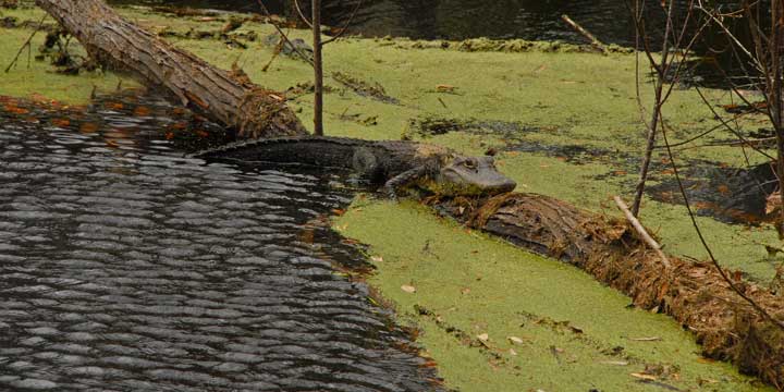
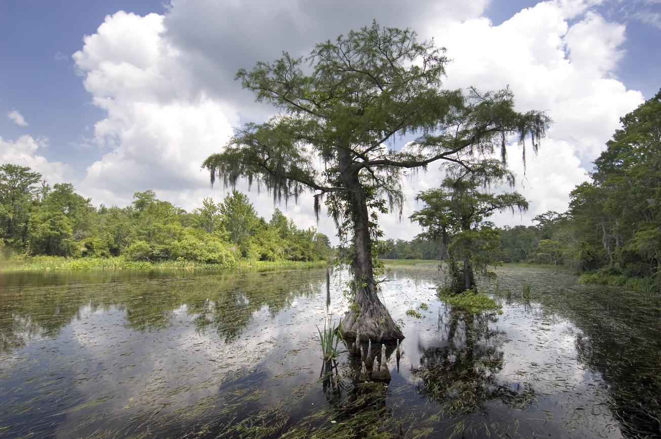
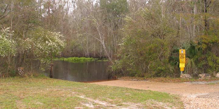
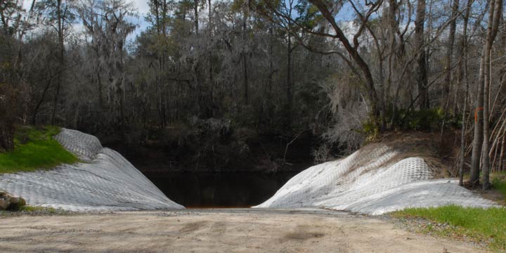
On this primitive tract, visitors may enjoy fishing as well as biking, hiking, horseback riding, and wildlife viewing on administrative roads. Hunting is allowed on the Turner Bridge tract, which is part of the Cypress Creek Wildlife Management Area. This tract has a boat ramp and also features picnic pavilions.

For more information on hunting, contact the Florida Fish and Wildlife Conservation Commission at:

386-758-0525
Florida Fish and Wildlife Conservation Commission Website

Note: Hunting is allowed in permitted areas only.

Access
Turner Bridge Tract from White Springs:
Travel north on CR 135, cross CR 6, continue north on 180th Boulevard (Woodpecker Road) 2 miles, turn right on NE 38th Trail to the parking area at the boat ramp.

Size
Turner Bridge – 207 acres

View Tract Details

MANATEE SPRINGS SOUTH

Recreation
On Manatee Springs Tract visitors may enjoy biking, hiking, horseback riding, and wildlife viewing.

Access
Manatee Springs South Tract from Chiefland:
Travel west on CR 320, turn left on NW 107th Terrace; at the 90° right turn the road becomes NW 132nd Place; travel 2.5 miles and the entrance is on the left.

View Tract Details

MANATEE SPRINGS STATE PARK

Recreation
The Manatee Springs State Park Tract is managed by the Florida Department of Environmental Protection as part of Manatee Springs State Park. Visitors may enjoy biking, hiking, horseback riding, and wildlife viewing. Usher Landing is used to launch boats as well as parking, picnicking, and fishing

For more information contact Manatee Springs State Park:

352-493-6072

Manatee Springs State Park

Access
Manatee Springs State Park Tract:
Access is managed by Manatee Springs State Park

Manatee Springs State Park Tract from Chiefland:

Travel west on CR 320, turn left on NW 107th Terrace; at the 90° right turn the road becomes NW 132nd Place; travel 3 miles and the entrance is on the right.

View Tract Details

MOUNT GILEAD

Recreation
On the Mt. Gilead Tract, visitors may enjoy biking, hiking, horseback riding, scenic viewing, and wildlife viewing, in addition to fishing and hunting. Many of the river access points provide launches for canoes, kayaks, or small boats.

Mt. Gilead is part of the Middle Aucilla Wildlife Management Area. Hunting is allowed in permitted areas only. For more information on hunting, contact the Florida Fish and Wildlife Conservation Commission at:

386-758-0525
Florida Fish and Wildlife Conservation Commission Website

Access
Mt. Gilead Tract from Monticello:
Travel south on CR 257 to Lamont, cross U.S. 19; travel 9 miles south crossing the Aucilla River, turn left on Rocky Ford Cemetery Road; travel 2 miles and the entrance is on the left.

View Tract Details

LAMONT

Recreation
The Lamont Tract, visitors may enjoy biking, hiking, horseback riding scenic viewing and wildlife viewing, in addition to fishing and hunting. Many of the river access points provide launches for canoes or small boats.

Lamont is part of the Middle Aucilla Wildlife Management Area. Hunting is allowed in permitted areas only. For more information on hunting, contact the Florida Fish and Wildlife Conservation Commission at:

386-758-0525
Florida Fish and Wildlife Conservation Commission Website

Access
Lamont Tract from Monticello:
Travel south on CR 257 to Lamont, cross U.S. 19; travel 3 miles to Lanier Grade, turn left and travel 0.75 miles, turn right on an Herndon Landing Road; travel 0.25 miles to the tract entrance.

View Tract Details

GOOSE PASTURE

Recreation
Visitors may enjoy biking, hiking, horseback riding, and wildlife viewing on administrative roads, in addition to fishing and hunting.

The Goose Pasture tract is a part of the Aucilla Wildlife Management Area. For more information on hunting, contact the Florida Fish and Wildlife Conservation Commission at:

850-265-3676
Florida Fish and Wildlife Conservation Commission Website
Aucilla Bird List (PDF)

Note: Hunting is only allowed in permitted areas.


Camping Area
The primitive camping area is open on a first-come, first-served basis by self-issued special use authorization, which is available at the kiosk. Campers are limited to a 10-day stay. Camping is not allowed during general gun season. The group camping area can be reserved for groups of six or more by contacting the District at:

386-362-1001
800-226-1066 (FL only)
Email Recreation


Access
Goose Pasture tract from Perry:
Travel 22 miles west on US 98 to Powell Hammock Road, turn right; travel north 4 miles, turn left on Goose Pasture Road; travel west 2.75 miles and the tract is on both sides of the road. Continue traveling west 1 mile and the road ends at Goose Pasture Campground.

View Tract Details

CABBAGE CREEK

Recreation
Visitors may enjoy biking, hiking, horseback riding, and wildlife viewing. in addition to fishing and hunting. Many of the river access points provide launches for canoes or small boats. Cabbage Creek Tract is part of the Lower Econfina River Wildlife Management Area.

The Econfina River traverses the tract from the north boundary to the southern boundary.  The river’s 239-square mile basin drains part of the Big Bend Region.  Its headwaters in San Pedro Bay the Econfina River’s character changes dramatically as it winds 44-miles through upland forests and meanders downstream to the palm-fringed salt marshes of the Gulf of Mexico.

The name “Econfina” derives from the Creek ekana, which means “earthy”, and feno, which means “bridge” or “foot log”. This name may refer to a natural bridge over the river in the Natural Well Branch Tract.

Hunting is allowed in permitted areas only. For more information on hunting, contact the Florida Fish and Wildlife Conservation Commission at:

386-758-0525
Florida Fish and Wildlife Conservation Commission Website

Access
Cabbage Creek Tract from Perry:
Travel west 16 miles on US 98, turn right into the boat ramp parking lot.

West Entrance from Perry:
Travel across the river on US 98, turn right on the Loughridge Grade (the first road to the right) and the tract is on the right.

North Entrance from Perry:
Travel west on US 98, veer right on Salt Grade; travel 3.5 miles and the entrance is on the left.

View Tract Details

ALAPAHOOCHEE

Recreation
On the Alapahoochee Tract visitors may enjoy fishing, as well as biking, hiking, horseback riding, and wildlife viewing. Sasser Landing Ramp is at the Alapahoochee Boat Ramp Park Tract.

Access
Alapahoochee tract from Jennings:
Travel east on CR 150, cross the Alapaha River and turn at the first driveway to the left.

Size
1,075 acres