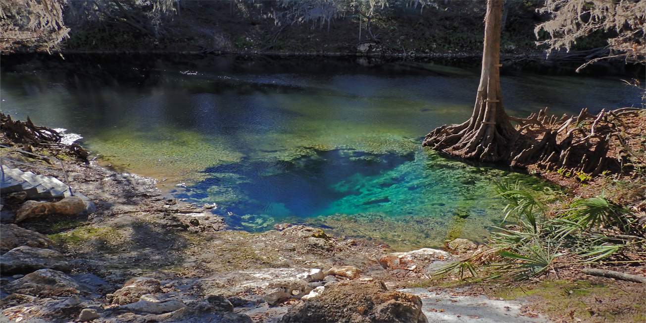
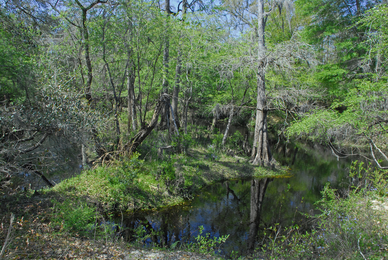
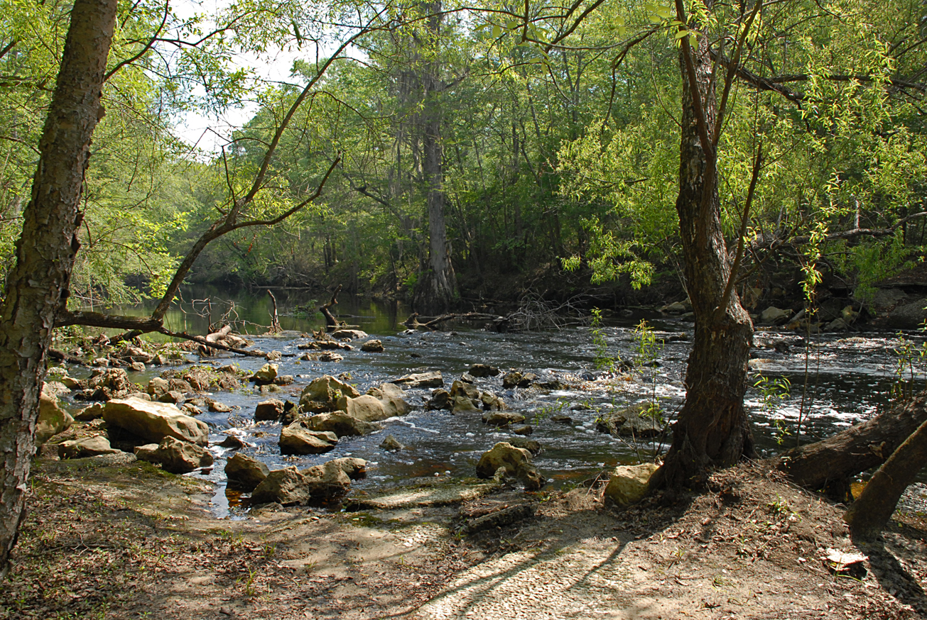
Facility: RIVER ACCESS
Recreation
Visitors may enjoy biking, hiking, horseback riding, and wildlife viewing on administrative roads. In addition to fishing and hunting.
This tract is part of Twin Rivers State Forest. For more information, call or visit:
386-208-1460
Florida Department of Agriculture and Consumer Services Website
For more information on hunting, contact the Florida Fish and Wildlife Conservation Commission at:
386-758-0525
Florida Fish and Wildlife Conservation Commission Website
Access
Withlacoochee Tract from Lee:
Travel north on CR 255, turn right on SR 6; travel east 5 miles, cross the Withlacoochee River turn right on SW 28th Lane; travel south .5 miles and the entrance is on the right.
-
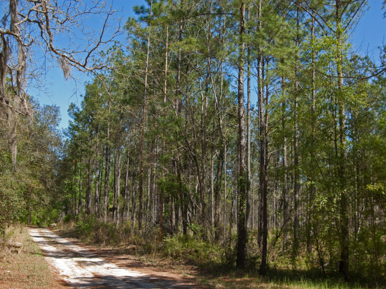
 Biking
 -
 Bird Watching
 -
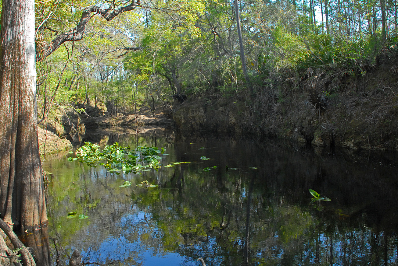
 Fishing
 -
 Hiking
 -
 Horseback Riding
 -
 Hunting
 -
 Parking
 -
 Picnic Area
 -
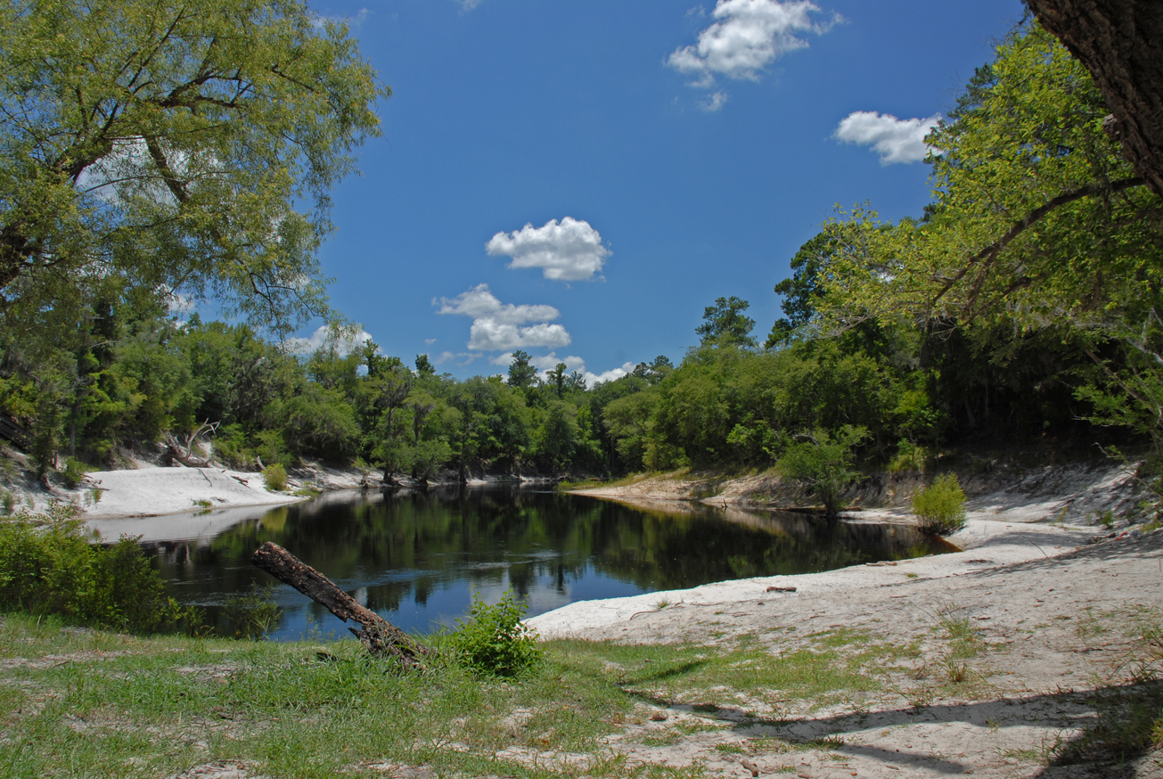
 Scenic Viewing
 -
 Wildlife Viewing
Recreation
Visitors may enjoy fishing, as well as biking, hiking, horseback riding, hunting and wildlife viewing on administrative roads.
This tract is part of Twin Rivers State Forest. For more information call or visit:
386-208-1460
Florida Department of Agriculture and Consumer Services Website
For more information on hunting, contact the Florida Fish and Wildlife Conservation Commission at:
386-758-0525
Florida Fish and Wildlife Conservation Commission Website
Access
Westwood West Tract from Lee:
Travel north on CR 255, turn right on SR 6; travel east 2 miles, turn left on Old Blue Springs Road; travel 5.75 miles north to NE Hickory Grove Road, turn right; travel north 2 miles and the entrance is on the right.
-
Biking
-
Bird Watching
-
Fishing
-
Hiking
-
Horseback Riding
-
Hunting
-
Parking
-
Picnic Area
-
Scenic Viewing
-
Wildlife Viewing
Recreation
Visitors may enjoy fishing, as well as biking, hiking, horseback riding, hunting and wildlife viewing on administrative roads.
This tract is part of Twin Rivers State Forest. For more information, call or visit:
386-208-1460
Florida Department of Agriculture and Consumer Services Website
For more information on hunting, contact the Florida Fish and Wildlife Conservation Commission at:
386-758-0525
Florida Fish and Wildlife Conservation Commission Website
Note: Hunting is allowed in permitted areas only.
Access
Westwood West tract from Lee:
Travel north on CR 255, turn right on SR 6; travel east 2 miles, turn left on Old Blue Springs Road; travel 5.75 miles north to NE Hickory Grove Road, turn right; travel north 2 miles and the entrance is on the right.
-
Biking
-
Bird Watching
-
Fishing
-
Hiking
-
Horseback Riding
-
Hunting
-
Parking
-
Scenic Viewing
-
Wildlife Viewing
Recreation
On this primitive site, visitors may enjoy hiking and wildlife viewing on administrative roads.
Access
Swift Creek tract from White Springs:
Take CR 25A west; the entrance to the Swift Creek tract is on the left.
Size
Swift Creek – 328 acres
 = Featured
-
 Camping Area
 -
Fishing
-
Hiking
-
Wildlife Viewing
Recreation
Visitors may enjoy fishing, as well as biking, hiking, horseback riding, and wildlife viewing on administrative roads.
Access
Stuart’s Landing South from Branford:
Travel west on US 27 to CR 349; turn left and travel 4.5 miles south to CR 480; turn left; travel to CR 500; turn left; travel to CR 190; turn right and travel east to SE Deer Trail Road; turn right and continue to parking areas on the left.
-
Biking
-
Fishing
-
Hiking
-
Parking
-
Scenic Viewing
-
Wildlife Viewing
Recreation
Steinhatchee Springs Tract is part of the Steinhatchee Springs Wildlife Management Area, visitors may enjoy biking, hiking, horseback riding, and wildlife viewing on administrative roads, in addition to fishing and hunting. Canoes, kayaks, and small boats may launch at some of the river access points.
For more information on hunting, contact the Florida Fish and Wildlife Conservation Commission at:
386-758-0525
Florida Fish and Wildlife Conservation Commission Website
Note: Hunting is allowed in permitted areas only.
Access
Steinhatchee Springs Tract from Mayo:
Travel south on SR 51 and the tract is on the left side of the road; continue 1.5 miles south and the tract is on both sides of the road.
- = Featured
-
Biking
-
Bird Watching
-
 Canoe Launch
 -
Fishing
-
Hiking
-
Horseback Riding
-
Hunting
-
Scenic Viewing
-
Wildlife Viewing
Recreation
The Steinhatchee Rise Tract is part of the Steinhatchee Springs WMA. Visitors may enjoy biking, hiking, horseback riding, and wildlife viewing, in addition to fishing and hunting. Canoes, kayaks, and small boats may launch at some of the river access points.
For more information on hunting, contact the Florida Fish and Wildlife Conservation Commission at:
386-758-0525
Florida Fish and Wildlife Conservation Commission Website
Access
Steinhatchee Rise Tract from Perry:
Travel south on US 19, cross the Steinhatchee River Bridge; travel 1.75 miles to SW 700th Street, turn right and the tract is on the right.
Steinhatchee Rise Tract from Cross City:
Travel north on US 19, turn left on SW 700th Street and the tract is on the right.
- = Featured
-
Biking
-
Bird Watching
-
Canoe Launch
-
Fishing
-
Hiking
-
Hunting
-
Scenic Viewing
-
Wildlife Viewing
Recreation
On the Sneads Lake Tract tract, visitors may enjoy fishing, as well as hiking, and wildlife viewing. The adjacent boat ramp provides access to Sneads Lake.
For waterfowl hunting information, contact the Florida Fish and Wildlife Conservation Commission (Northwest Region) at:
850-265-3676
Florida Fish and Wildlife Conservation Commission Website
Access
Sneads Lake Tract from Monticello:
Travel northeast on CR 146 to Sneads Landing Road, turn right; travel to the end of road and the tract is on the right.
-
Bird Watching
-
Fishing
-
Wildlife Viewing
Recreation
On the Seven Bridges Tract, visitors may enjoy fishing, as well as biking, hiking, horse back riding, and wildlife viewing.
Access
Seven Bridges Tract from Monticello:
Travel east on US 90 to CR 257; turn left and travel 4 miles to Sparks Road; turn left and travel east 1.75 miles; the first access point is on the left. Continue to Seven Bridges Road; turn left and the second access point is at the end of the road on the left.
-
Biking
-
Bird Watching
-
Fishing
-
Hiking
-
Scenic Viewing
-
Wildlife Viewing